
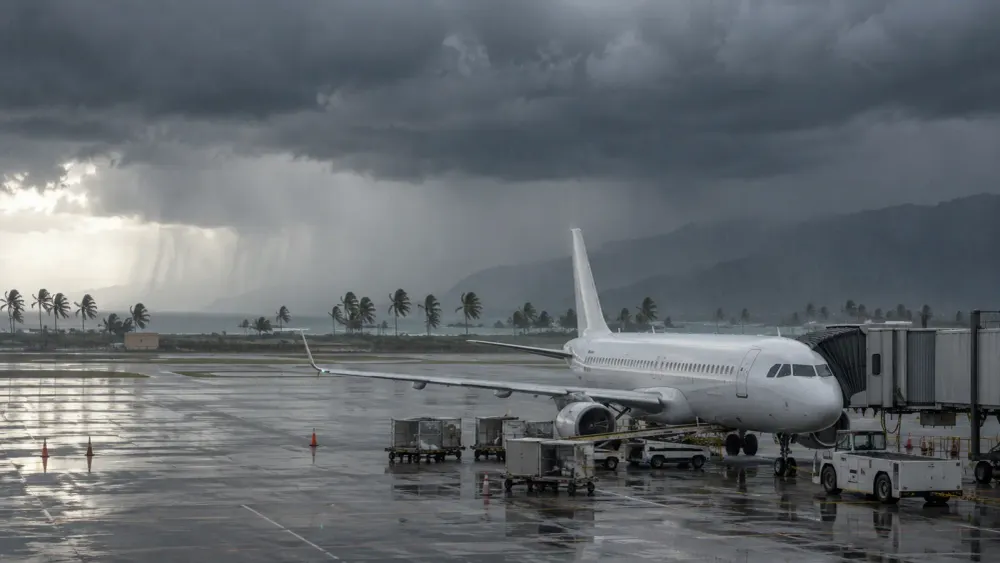
A 110-mph Hurricane Lowell was 170 miles southwest of Līhuʻe late Monday, disrupting flights to Kauaʻi and prompting officials to close schools, government offices and outdoor attractions as its core approached Hawaiʻi’s westernmost islands. The National Hurricane Center’s 5 p.m. Hawaiʻi time advisory placed the Category 2 storm on a north-northeast track at 18 mph, with hurricane conditions expected in Kauaʻi County during the evening and tropical-storm conditions on Oʻahu.
The storm’s travel effects were serious but uneven. Hawaiʻi’s official visitor guidance said most airports were operating normally statewide, while several flights to and from Līhuʻe Airport had been affected. Kauaʻi and Niʻihau were under a hurricane warning, Oʻahu was under a tropical-storm warning, and a statewide flood watch covered every major island through Tuesday afternoon.
That geography matters for travelers deciding whether to cancel, reroute or remain in place. Lowell was forecast to pass near or just west of Niʻihau overnight rather than cross the entire island chain, but its tropical-storm-force winds extended as far as 175 miles from the center. Officials advised people already on Kauaʻi to remain at their accommodations, avoid unnecessary road travel and treat airline, park and activity schedules as changeable.
A Close Approach With a Wide Hazard Field
Lowell weakened from its earlier peak before approaching Hawaiʻi, yet the storm remained capable of affecting islands well beyond its center. Hurricane-force winds extended up to 70 miles outward, while Līhuʻe Airport had already reported sustained winds of 38 mph and a gust of 49 mph by late Monday afternoon. The National Hurricane Center expected Lowell to remain a hurricane during its closest approach before turning northwest and slowing after passing the islands.
Rain posed a separate threat from the wind. The National Weather Service reported that 6 to 10 inches had already fallen on Kauaʻi, with 2 to 5 inches on Oʻahu and Maui County, by 4:25 p.m. Monday. Its latest forecast discussion warned that additional heavy bands could produce rapid flash flooding and mudslides, particularly on Kauaʻi and parts of the Big Island.
The hurricane center said Kauaʻi could receive another 4 to 8 inches, with maximum storm totals reaching 24 inches in isolated areas. It projected a storm surge of 2 to 4 feet above ground in parts of Kauaʻi County if the peak coincided with high tide, compared with up to one foot on Oʻahu. Several tornadoes were also possible near Kauaʻi and Niʻihau, and dangerous surf was expected across many islands.
Flights Continue, but Flexibility Has Become Essential
The operating picture was not a blanket closure of Hawaiʻi’s air system. The Hawaiʻi Tourism Authority’s visitor guidance said several Līhuʻe flights had been affected but most airports continued to operate normally. It urged passengers to consult their airline before leaving for the airport because flight schedules can change faster than airport-wide notices.
Airlines responded with differing waiver boundaries, reflecting their networks and assessment of likely disruption. American Airlines’ current travel alert covered Honolulu, Kahului, Kona and Līhuʻe for trips scheduled from September 6 through September 9. Eligible passengers who bought tickets by September 4 could make a one-time change without a change fee for travel through September 14, provided they retained the same origin and destination.
A waiver does not necessarily mean a flight is canceled, and it does not guarantee that every associated cost will be reimbursed. Fare differences, hotel nights, rental cars and separately booked activities can be governed by different contracts. Travelers should preserve receipts and written notices, review the terms of any travel insurance, and avoid assuming that an airline’s schedule change automatically extends to lodging or tours.
Hawaiʻi’s island geography can amplify even a localized interruption. Passengers often connect through Honolulu before taking an interisland flight, so a canceled Līhuʻe segment can affect a longer itinerary without closing the larger hub. Aircraft and crews displaced by weather may also need time to return to schedule after warnings expire. That makes the first available replacement flight only one part of recovery; seat availability, airport ground conditions and the reopening of roads and accommodations also determine when a journey can resume.
International authorities were also drawing distinctions by location. Canada’s government changed its U.S. travel advice Monday to recommend avoiding nonessential travel to Kauaʻi County and part of the Papahānaumokuākea Marine National Monument. The broader United States remained at its normal precaution level, illustrating why island-specific warnings are more useful than a generalized view of Hawaiʻi.
Closures Reach Beyond the Airport
Travel disruption extended into the places visitors would ordinarily go after landing. Governor Josh Green ordered state and county offices, public schools, University of Hawaiʻi campuses and judiciary facilities on Oʻahu and in Kauaʻi County closed Tuesday. The state’s closure order kept essential and emergency services operating while seeking to reduce road traffic during the most dangerous period.
State parks on Kauaʻi were closed until further notice, including destinations that require reservations and advance planning. The Department of Land and Natural Resources also closed Oʻahu parks as the tropical-storm warning took effect. Its park notices cited flash flooding, storm surge and flying tree limbs, hazards that can persist even when a hotel or airport remains open.
The practical consequence is that an operating flight does not mean a planned itinerary remains safe or available. Hiking trails, beaches, shuttles, tours and rental-car routes may close independently. Visitors who remain on Kauaʻi were advised not to evacuate unless directed by local officials, because unnecessary movement can place travelers on flood-prone roads and compete with emergency traffic.
The Forecast Does Not Affect Every Trip Equally
The Associated Press reported that the greatest immediate threat was concentrated on Kauaʻi and Niʻihau, with damaging winds, mudslides, rip currents and possible tornadoes. Oʻahu faced tropical-storm conditions and potentially heavy rain, while Maui County and the Big Island were outside the hurricane warning but remained exposed to flooding and surf.
That distribution creates two risks of misinterpretation. One is treating a forecast track west of the islands as proof that no disruption will occur; wind radii, rainbands and surf extend far from the eye. The other is treating a Kauaʻi hurricane warning as evidence that every Hawaiian airport and resort faces the same conditions. Neither conclusion matches the official record.
The tourism authority advised travelers arriving in future weeks or months that they did not need to change plans solely because of the current forecast. That guidance is consistent with the storm’s expected movement away from the state, but it is not a promise about damage or reopening times. Roads, utilities and individual businesses can require inspections after winds subside, and rainfall can prolong flooding beyond the closest approach.
What Travelers Should Watch Next
The most important near-term evidence will come from observed conditions rather than the forecast cone alone. Changes in wind at Līhuʻe Airport, flash-flood warnings, road closures and airline flight status will show whether disruption remains concentrated or spreads. The National Weather Service cautioned that a small shift in Lowell’s track or intensity could materially change conditions for Kauaʻi County.
Travelers should use official island and airline channels for decisions that depend on timing. A hotel can confirm whether it has power and access, an airline can identify an actual cancellation or waiver, and county emergency managers can determine whether movement is safe. Beach conditions deserve separate attention because hurricane swells can create life-threatening surf and rip currents even after rain or wind appears to ease.
Lowell has already altered travel through flight changes, public closures and the suspension of outdoor access. What remains unknown is the duration: a westward pass followed by limited damage could allow a quick recovery, while flooding, debris or utility failures could extend disruption. Until inspections and Tuesday’s observations clarify that outcome, the evidence supports postponing nonessential movement on Kauaʻi and treating plans elsewhere in Hawaiʻi according to local conditions rather than a statewide assumption.