🎧 Listen to this article:
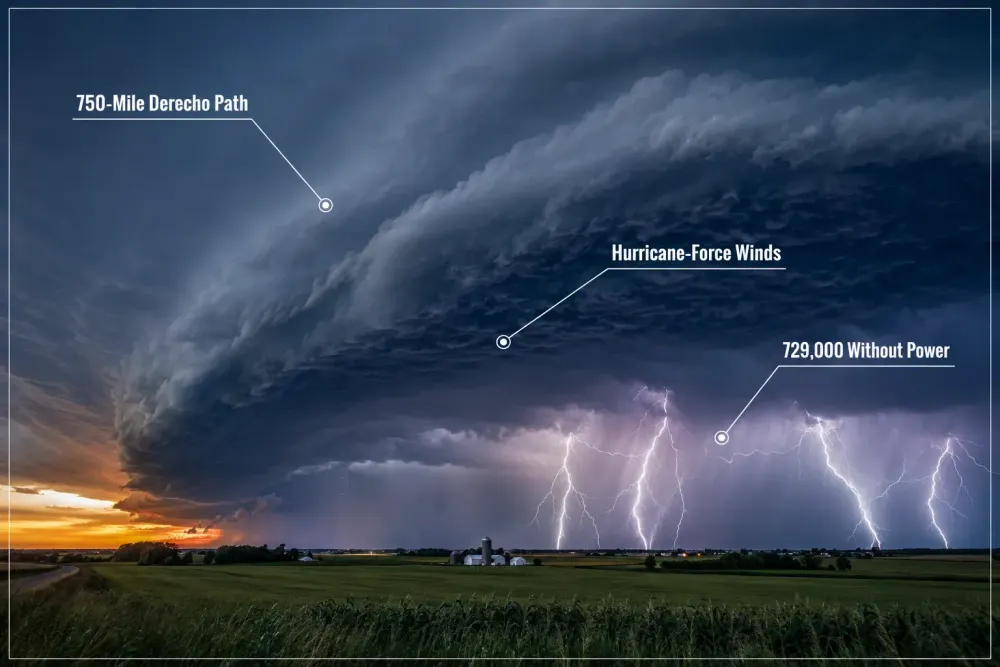
Nearly 730,000 homes and businesses across five states were still without electricity as of midday Wednesday after a single line of storms tore from Iowa to West Virginia, according to Reuters, leaving at least four people dead, prison inmates struck by lightning, and entire Ohio towns cut off by floodwater a full day after the system passed through.
The storm system swept across Illinois, Indiana, Ohio, Kentucky and West Virginia on Tuesday and into Wednesday, and forecasters at the National Weather Service's Storm Prediction Center have preliminarily classified it as a derecho — a fast-moving band of thunderstorms that produces widespread, hurricane-force straight-line winds over a long, narrow corridor, according to the Columbus Dispatch. The National Weather Service's Chicago office separately confirmed three tornadoes touched down south of the city, with damage consistent with at least EF-1 intensity, according to its storm survey. Wind gusts reached 99 mph in Gary, Indiana, and 82 mph at Columbus's John Glenn International Airport, according to the Associated Press and WYSO radio.
The human toll became clearer as cleanup crews reached areas that had been isolated by downed trees and washed-out roads. A 4-year-old boy died in Geneva Township, Indiana, after a tree collapsed onto his family's home, according to the Jennings County Sheriff's Office, cited by Reuters. In Roseville, Ohio, a resident died during a medical emergency because flooded roads prevented first responders from reaching the home in time, Governor Mike DeWine said, according to both Reuters and the Associated Press. Police in Portage, Indiana, are separately investigating whether the storm played a role in a house explosion that killed one person there. Beyond the fatalities, 16 inmates at Grafton Correctional Institution in Lorain County, Ohio, were struck by lightning while walking a routine outdoor path back from the dining hall, and four were hospitalized with serious injuries, according to WYSO. DeWine noted that standard protocol calls for clearing outdoor areas during storms, but staff had received no warning indicating lightning risk at that moment.
The mechanics of the storm explain why the damage was so geographically dispersed. A derecho forms when a cluster of thunderstorms organizes into a bowed, fast-moving line — in this case racing east-southeast at 35 to 40 mph, according to NWS forecast — that channels a continuous downdraft of wind along its leading edge rather than dissipating the way an ordinary thunderstorm does. That structure explains the two distinct hazard profiles seen this week: widespread straight-line wind damage stretching hundreds of miles, punctuated by isolated, short-lived tornadoes spun up along the same line as it crossed northern Illinois and northwest Indiana. National Weather Service meteorologist Kristen Cassady said the agency's primary concern Tuesday morning was the damaging straight-line wind threat, which is why a tornado watch was never issued for Franklin County, Ohio, even as wind gusts caused damage that many residents mistook for a tornado, according to WYSO. Franklin County's Emergency Management office does not activate tornado sirens absent a tornado warning, leaving some south Columbus neighborhoods without an audible alert even as roofs were torn off buildings.
Rainfall totals compounded the wind damage into a slower-moving flooding crisis. Dayton, Ohio, recorded 2.07 inches of rain in a single day, breaking a record that had stood since 1915, according to the Associated Press. In parts of northern Indiana and northwest Ohio, the National Weather Service recorded 2 to 5 inches of rain in a single evening, prompting an extended flood watch across more than a dozen counties. In southeastern Ohio, the town of Roseville was left with only one passable road out, and Governor DeWine activated the Ohio National Guard to assist Perry and Muskingum county communities cut off by high water, according to WYSO. An American Electric Power spokesperson told reporters it could take until Friday for crews to physically reach flood-isolated towns like Athens and Crooksville to begin restoring service, illustrating how flooding, not just wind damage, is now the binding constraint on recovery timelines.
The scale of the outages reflects both the storm's reach and the vulnerability of an above-ground utility grid to falling trees. Indiana absorbed the heaviest hit, with roughly 297,000 customers without power — about 9% of the state's tracked customer base — followed by Ohio at nearly 201,000, Illinois at 147,000, Kentucky at 62,900 and West Virginia at 21,500, according to PowerOutage.us data compiled by Reuters. In Columbus alone, nearly 100,000 Franklin County customers lost power at the peak, with American Electric Power's Ohio president, Marc Reitter, saying crews expected most central Ohio outages to be resolved by Wednesday even as tens of thousands elsewhere in the state faced longer waits, according to 10TV. Columbus Mayor Andrew Ginther declared a formal mayor's emergency Wednesday, saying the storm triggered the largest single-day response in the history of the city's fire division — every unit was in service simultaneously at one point, answering more than 1,100 calls — while noting, notably, zero fatalities and zero emergency-room transports within city limits despite the intensity of the winds, according to the Columbus Dispatch.
The disaster also illustrates a broader seasonal pattern meteorologists have been tracking. Forecasters described the system as riding the northern edge of a "ring of fire" — a configuration in which a persistent dome of high pressure over the southern United States funnels repeated waves of moisture and instability along its northern perimeter, generating successive rounds of severe weather rather than a single, isolated event, according to the Associated Press. That pattern is why the danger has not ended: the National Weather Service warned that renewed rounds of severe thunderstorms and heavy rainfall will continue across the Midwest, Ohio Valley and central Appalachians into the weekend, with flood hazards in the Ohio Valley expected to persist through at least early Friday. For residents already dealing with structural damage, blocked roads and downed power lines, that forecast means recovery crews are racing against a clock that keeps resetting — clearing debris and restoring lines even as the next wave of rain moves in behind them.
For a storm system that produced no single catastrophic landmark — no collapsed stadium, no washed-out interstate bridge — the cumulative disruption has been substantial precisely because it struck so many separate systems at once: electrical grids, correctional facilities, municipal fire departments, rural roads and low-lying river towns, each absorbing damage on its own timeline. Ohio's governor and Columbus's mayor both framed their public updates around the same theme: the storm's severity was matched, and in places exceeded, by the speed and coordination of the response, from National Guard deployment in flooded southeastern counties to Red Cross shelters standing ready within hours. Whether that response holds up as a model or as merely a stopgap will depend largely on what the next 48 hours bring, given that forecasters are not describing this week's severe weather as an isolated event but as one episode within a longer-running pattern that shows no sign of breaking immediately.
The episode underscores a structural reality of the region's infrastructure: aging above-ground distribution lines and a tree canopy overhanging many residential streets make wind-driven power loss almost inevitable in derecho-strength events, regardless of utility investment in storm hardening. Emergency shelters opened by the American Red Cross in Franklin and Perry counties sheltered dozens of displaced residents overnight, according to WYSO, a modest but telling sign of how quickly a single afternoon storm can outstrip a region's ability to absorb the damage without state and federal support.