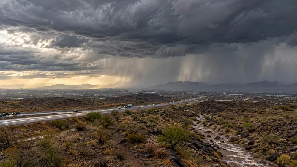
About 28 million people were under flood watches Tuesday as tropical moisture associated with Hurricane Polo spread into the U.S. Southwest, where flooding had already begun in southern New Mexico and a broader threat was building from Texas toward the central Plains. The estimate comes from a watch count compiled early Tuesday; current National Weather Service forecast pages separately showed a flash-flood warning and a flood watch across most of New Mexico.
The danger is not confined to the remnant center of Polo. The National Hurricane Center had forecast that the cyclone itself would dissipate over mainland Mexico before reaching the United States, while its NHC discussion said moisture associated with Polo and another Pacific system would be transported into the Southwest and contribute to heavy rain. That distinction matters: the U.S. hazard is an expanding rainfall pattern combining tropical moisture with other slow-moving weather systems, not a hurricane making a U.S. landfall.
Flooding begins in New Mexico
New Mexico is the first major U.S. focus. The Albuquerque weather office said most locations could receive 1 to 3 inches through early Wednesday, with isolated totals of 4 to 6 inches where thunderstorms repeatedly cross the same area. Its state outlook placed much of New Mexico under a slight-to-moderate excessive-rainfall risk, with the highest-end moderate risk concentrated in the northeast. Independent AP reporting said heavy rain was already drenching parts of the Southwest and causing flooding Tuesday morning.
The state office also warned that embedded storms could produce damaging wind and possibly isolated tornadoes, while saturated soil may make larger trees more vulnerable. Burn scars, dry washes and steep terrain are particularly sensitive because intense rainfall can run off rapidly instead of soaking into the ground. A separate regional analysis identified burn scars in New Mexico and Colorado as vulnerable to flash floods and debris flows.
Texas watch expands before the heaviest rain
The threat widens Wednesday across North and Central Texas. The National Weather Service office serving Dallas-Fort Worth said a flood watch covers much of the region along and west of Interstate 35 from Wednesday afternoon through Thursday afternoon. Forecasters expect average totals of 2 to 5 inches, with isolated amounts near 8 inches, and warned that another round could affect Central Texas from Thursday night into Friday.
The watch includes major population centers along the Interstate 35 corridor. Local reporting identified San Antonio, Austin and Dallas-Fort Worth within the broad watch area and said a separate watch near El Paso remains in effect into early Wednesday. Houston is expected to face its more significant rain window later Thursday into Friday, but forecasters said the placement of the heaviest bands remains uncertain.
Severe weather may accompany the rainfall as the system arrives. The Dallas-Fort Worth office said some storms could become severe late Wednesday, while the broader pattern could produce locally intense downpours where tropical moisture intersects a slow-moving front and upper-level disturbance. The forecast remains conditional: the exact flood impacts will depend on where repeated storms develop and how quickly the system moves.
A multi-state corridor faces repeated rainfall
The broader risk extends beyond New Mexico and Texas. Arizona and Utah have already experienced localized high-water and debris-flow incidents, while Colorado becomes a principal concern as moisture is drawn northward. Farther east, the pattern may affect Nebraska, Kansas, Oklahoma, Missouri, Iowa and Illinois through Thursday. The Washington Post’s forecast review highlighted both the Interstate 80 corridor from Nebraska into Iowa and the Interstate 35 corridor from Missouri through Texas as elevated-risk zones.
NOAA forecasters projected three consecutive days with a moderate excessive-rainfall risk somewhere in the affected region, the second-highest tier on the agency’s four-level scale. New Mexico’s weather office likewise described moderate-risk areas persisting through Tuesday and a smaller risk area lingering Wednesday. The repeated-day setup increases concern because later storms can fall on ground already saturated by earlier rounds.
Polo weakens, but its moisture remains consequential
Polo struck Baja California Sur as a Category 2 hurricane with 110-mph winds before weakening while crossing the Gulf of California, according to the Associated Press. Mexican officials reported flooded streets and fallen trees but no deaths or serious damage, and about 700 people had sheltered. Reuters reported the storm had weakened to Category 1 strength before its expected mainland Mexico landfall.
Those lower wind speeds do not end the U.S. rainfall threat. Moisture can continue moving far from a weakening tropical cyclone and become incorporated into a different weather system. In this case, forecasters expect the imported moisture, a slow-moving front and an upper-level disturbance to sustain several rounds of rain across a wide corridor.
Warnings will determine where danger becomes immediate
A flood watch means flooding is possible; a flood or flash-flood warning means it is happening or about to happen, the Dallas-Fort Worth office explained in its public guidance. That difference will be central over the next several days as broad watches are converted into more targeted warnings based on radar, rainfall rates and reports from the ground.
New Mexico’s most intense period was expected Tuesday into early Wednesday, while the Texas threat builds Wednesday and can persist into Friday. Residents across the watch corridor should use their local National Weather Service office for the latest warning boundaries because the national risk area is much larger than the places that will ultimately experience damaging floods. The next material developments will be observed rainfall totals, any expansion of flash-flood warnings and whether repeated storms concentrate over cities, burn scars or other terrain where water rises quickly.